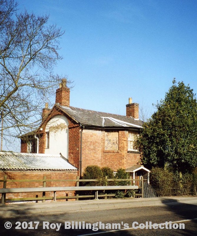
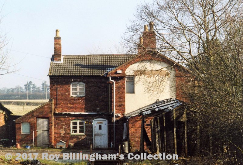
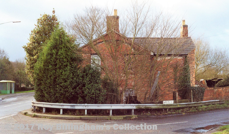
Tamworth Road, Sutton Coldfield
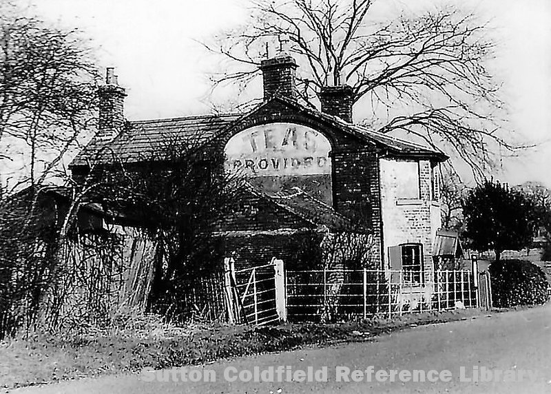
The last surviving tollhouse in Birmingham
Ordnance Survey Grid Reference: SP 145 989
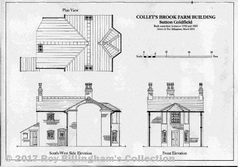
Collet’s Brook Farm is located on the western side of the A453 Tamworth Road in Sutton Coldfield adjacent to its junction with Fox Hill Road and is Grade II (Statutory List) listed. It once belonged to the Birmingham to Watford Gap Turnpike Trust before being sold to John Sutherland Valentine on September 9, 1831. It probably dates from before 1815.
In his “History of Sutton Coldfield”, W.K. Riland Bedford states, “The Corporation……in 1792 paved the streets (with cobblestones) at the expense of £350, but the high roads from Watford Gap to Chester-road, and from Canwell to Sutton Coldfield were placed under trustees, and toll-gates were erected at the north end of Sutton, at Ashfurlong, and at Collet’s Brook”.
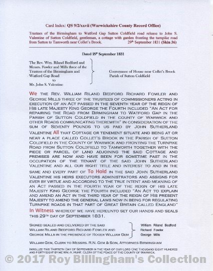
The 1831 Conveyance (Document 2), which is housed in the archives of the Warwickshire County Records, confirms the original ownership of the cottage and implies that it was built as a tollhouse by the earlier Chester Road to Watford Gap Turnpike Trust set up by the Warden and Society of Sutton Coldfield in 1792.
The condition of the Chester Road to Watford Gap and the Sutton Coldfield to Tamworth Turnpikes did not improve after 1792 which led to this local Turnpike Trust being replaced. For a trust to function properly, it needed to be established as a Turnpike Trust by act of Parliament. The first Turnpike Act for the Sutton roads was passed in 1807 and it highlighted the parlous state of the Sutton roads which it described as “…in so ruinous a Condition as to be unsafe for the Passage of Cattle and Carriages”. More to the point, it stated that the existing Trust had insufficient powers to improve the condition of the roads. The 1807 Turnpike Act was renewed in 1817 and 1827.
This means that the cottage could have been built as late as 1807 but more likely it was built at some time soon after 1792 when the earlier Turnpike Trust was set up to remove the financial burden of the road’s maintenance from the Town’s rates. Tollgates were erected in 1792 at the locations mentioned above but the 1807 Act limited the number of gates to only one gate per road so those at Watford Gap (Blake Street/Lichfield Road) and Collet’s Brook were removed and the tollhouses at both locations became redundant.
The Sutton Coldfield Parochial Valuation of 1856 indicates that Collet’s Brook Farmhouse was then owned by Solomon Smith of nearby Fox Hill House and occupied by Joseph Brookhouse, a tenant. The plot was described as “… a site of house and garden of area 1 rod, 12 perches.” The buildings on the plot comprised:
House, 2 storeys 19’-3” x 24’
House, back part 13’-0” x21”
Cowhouse 15’-0” x 16’
For more information refer to Proceedings of the SCLHRG, Vol. 7: Summer 2004, pp. 18-25.